Northern New Zealand is now becoming drier than normal and warmer than normal - on top of an annual rainfall deficit.
It's an increasingly concerning set up so early before summer as NZ appears to be catching some of Australia's dry weather patterns, says WeatherWatch.co.nz
"Rainfall in the upper North Island is below average in a number of regions.
"On Tuesday we reported about how dry Waikato has become with one farmer telling us he has only had 700mm of rain so far this year, normally the region gets around 1100mm per year. That quite a lot of rain that needs to fall between now and December 31 to catch up."
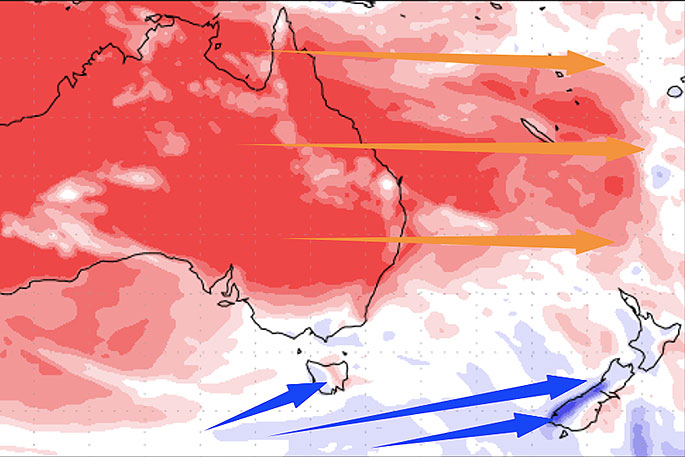 NEXT 7 DAYS shows dry weather continuing to stretch out of Australia, while the Southern Ocean and south Tasman Sea region continues to help produce rain makers. Data thanks to the US Govt. Red = Drier than normal, white = average rainfall, blue = wetter than usual. This graphic captures the forecast rain for the upper North Island this Sunday/Monday too - there's a fine line between red, blue and white shading around northern NZ.
So rain this weekend is important - not just because things are drying out fast with this warmer than average weather (and the windier weather in the weeks before that) but also because the forecast beyond the start of next week (which is showery and cooler in northern NZ) sees a return to mainly dry, warm weather and high pressure.
"If rain fails to fall this weekend for some dry northern areas then we receive no decent rainmakers for another couple more weeks, plus add on top of that warmer than average weather and a drier year so far it's not hard to see how the big dry could become more of a situation fast if soaking rains don't start returning to the north," says head forecaster Philip Duncan.
While rain is forecast with heavy falls and isolated thunder later this weekend and early next week, the nature of our mountains and ranges means some people will miss out.
"We're two small mountainous islands partially in the roaring forties, our weather is tricky to get right short term let along weeks or months out but this current weather pattern needs to change if we don't want to get too dry too fast."
High pressure drifting out of Australia has a done an effective job at blocking southern rainmakers from heading too far north up NZ and from stopping sub-tropical rainmakers from moving in.
The West Coast has had many rain events but the rain bands have been falling apart as they move into the North Island, in part due to much higher pressure drifting out from Aussie to our north and linking with high pressure out to NZ's north east.
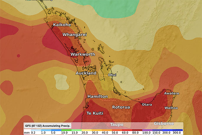
 7 DAY RAINFALL OUTLOOK FOR ALL NZ - As you can see heavy rain (in purple and dark blue) is patchy. Some areas get relief, others don't get enough. It's what we often call a "hit and miss" set up. Data via ECMWf.
"Long range models show this pattern of highs coming out of Aussie over NZ may increase in the next couple of weeks. Some may argue it's an early start to summer this year, after all we have Christmas temperatures already in the first week of November."
Philip says there will be a colder southerly on Monday and Tuesday but conditions warm up again mid to late next week and may well linger into the last week of November.
The West Coast is most exposed to heavy rain events - but there is also some chance of heavy rain in the upper North Island this Sunday, especially around Bay of Plenty.
Being hit and miss it's the reason why we've put together this news story and rain maps, to help people better understand what is a little bit of a complicated set up.
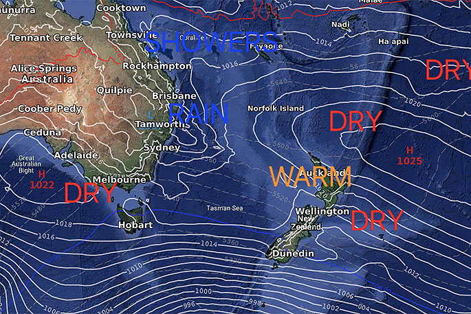 ECMWF (European modelling) for Monday, November 18.
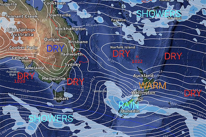 GFS (US Modelling) for two weeks from today, Friday, November 22.

0 comments
Leave a Comment
You must be logged in to make a comment.