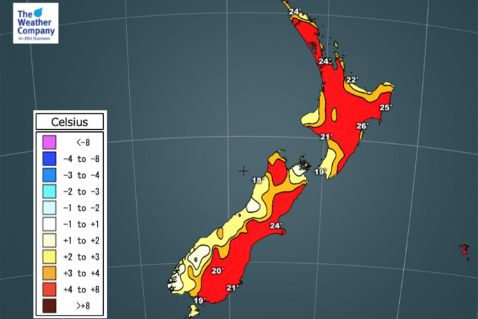
Sub-tropical and nor'west airflows are keeping most of New Zealand warmer than average. Not just for the last half of November. Not just for the first week of December. But potentially into next week and beyond, says WeatherWatch.co.nz
'Let's be clear, not every single part of the country is above normal. The rain and sometimes cooler Southern Ocean flows are making for some "average" (not below average) temperatures by day around coastal parts of the West Coast and Southland, also around Taranaki.
'However as a general theme sub-tropical winds are hugging the upper North Island and as we head towards the weekend they will again spread further afield. The nor'west flow combined with this makes things hotter. Hawke's Bay again is pushing to 30 degrees today. The region has been well above normal in recent weeks.”
Most North Island regions and the eastern South Island are leaning warmer than average for December and Summer, according to WeatherWatch.co.nz.
'We do have a cooler change coming this Sunday/Monday - but it's short lived
'On Sunday the leftovers of the Southern Ocean low will move across New Zealand with a cooler S to SW winds behind it. This means all of New Zealand does get a cooler - or more refreshing - change on 'Sunday and/or Monday.
But sub-tropical winds from Queensland may be returning to the North Island as fast as 24 hours later, by next Tuesday. Beyond that we see more highs coming out of Australia's drought for northern NZ bringing mainly warm, dry, air while further south the westerlies continue.”

0 comments
Leave a Comment
You must be logged in to make a comment.