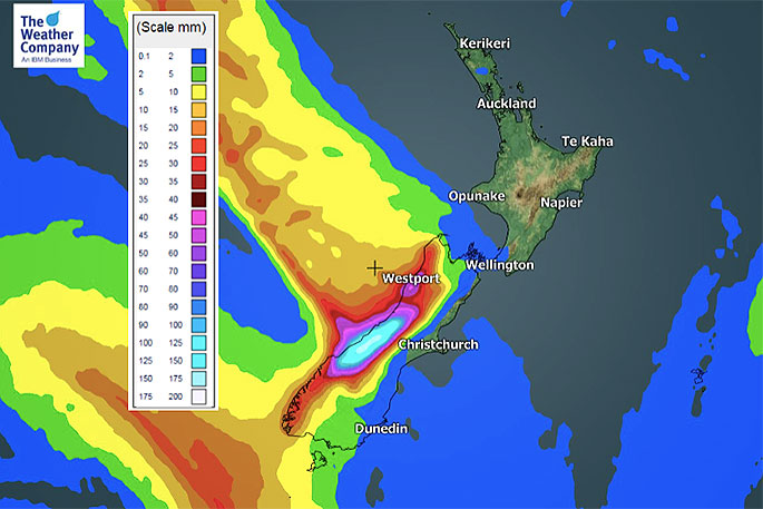
A deluge moving up the West Coast Friday will fall apart by the time it moves into the western North Island on Saturday, says WeatherWatch.co.nz.
Friday's deluge is significant with 200mm possibly falling within just 24 hours from about Hokitika southwards to the glaciers, up in the mountains. This could cause flooding, slips and some road closures.
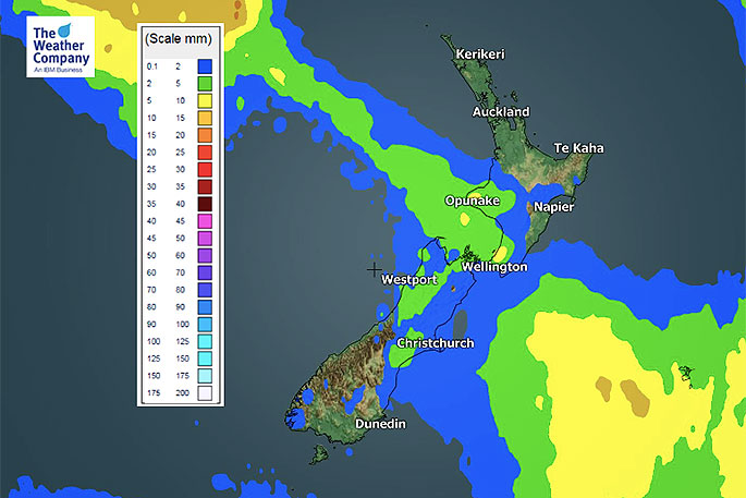
But the front isn't going to be dumping much wet weather over the dry North Island.
"The front moves into Taranaki and the south west corner of the North Island and will bring some rain and showers on Saturday but will be fast falling apart.
"The further north the front goes the more high pressure it runs into and the faster it dies."
 Forecast rain for Saturday.
It looks as though any wet weather will make it to about Taranaki or Waitomo. Any showers north of that will likely be so light and isolated they may not even be worth mentioning.
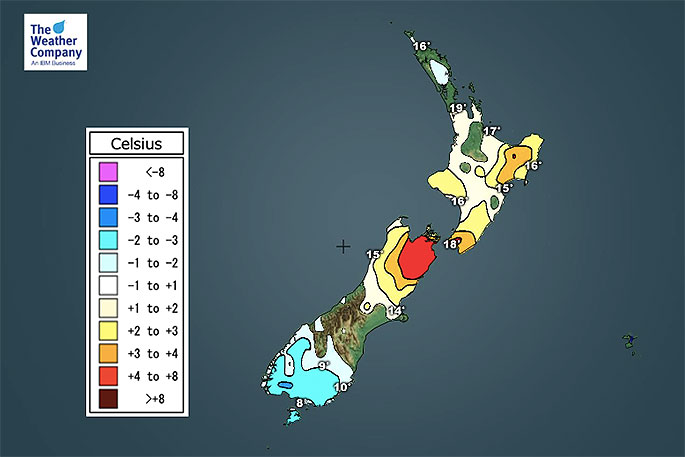
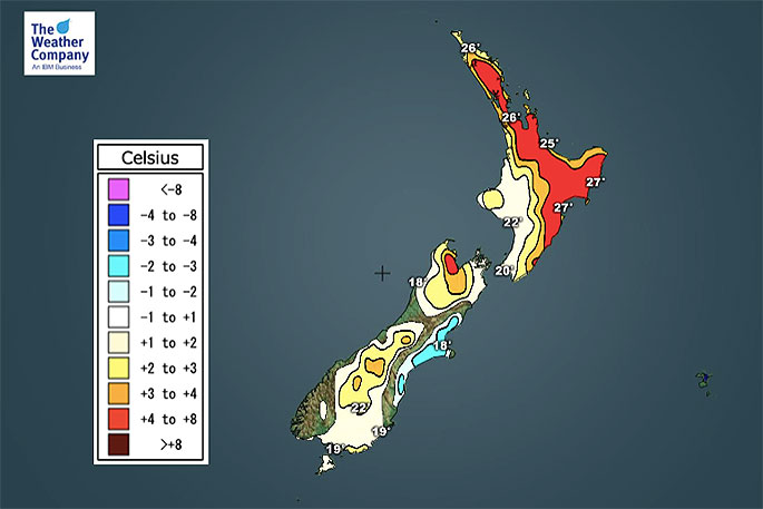
"Meanwhile, Friday is hotter than average in most places but the cold front in the South Island does have cooler air behind it - so Saturday night and day will be a little cooler in some regions, like Canterbury which could be nearly 10 degrees cooler on Saturday compared to today, Friday."
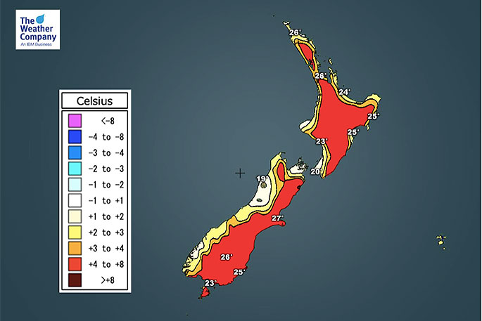 Forecast temperatures for Friday.
 Forecast temperatures for Friday night.
 Forecast temperatures for Saturday.

0 comments
Leave a Comment
You must be logged in to make a comment.