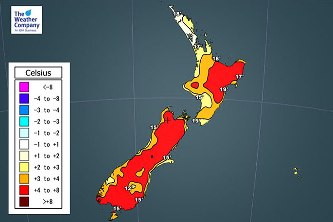
Weather forecasters are predicting a warmer than average day for most of New Zealand today.
WeatherWatch.co.nz weather analyst Aaron Wilkinson says with New Zealand being in winter now, anything seemingly warm is usually welcome.
"Western parts of the North Island are only a tad above average as a southwest airflow coming off the Tasman Sea keeps temperatures down a little compared to normal for this time of year.
"The warmest highs will likely be about Bay Of Plenty and Hawke's Bay sitting between 18 and 21 degrees. The coolest highs about Central Otago around 12 to 13 degrees.
"A ridge brings cooler than average overnight lows for Auckland and Northland tonight meanwhile a northwest airflow brings warmer than average overnight lows for Fiordland / Southland."
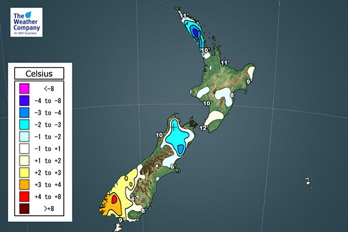 The minimum temperature departure from normal for today.
For Max & Min NZ Temperature maps for the next few days and nights ahead, please visit our new maps page: https://www.weatherwatch.co.nz/maps-radars/temperature/temperature

0 comments
Leave a Comment
You must be logged in to make a comment.