Last April, torrential rains caught the hamlet of Ngongotaha by surprise. A cascade of biblical levels rushed down two streams through Ngongotaha and Waiteti.
The rains also flooded much of Rotorua, making a lake of Kuirau Park. Worse, the rains welled up under established low-lying homes.
Someone had to be blamed. Magnanimously, two local authorities shouldered the blame. The public clearly wanted answers to a situation few could have scarcely predicted. The big wet from the Bay of Plenty coast dumped its fury on Rotorua.
The Rotorua Lakes Council and Bay of Plenty Regional Council – which a local lakes councillor the other day still called EBoP – took to heart a report which criticised lack of preparation for what these days are termed an ‘event' when it was a disaster for many young families at Ngongotaha.
Two days ago, close to a year since the ‘event', Rotorua Now took a cycling tour to one area affected by the floods. We chose an area between the streams. Much has changed, for the better, along the lake front.
Where not too many years ago frontages of homes were open prairies leading to Lake Rotorua, the area has been reappointed into one of the most pleasant walks/cycle ways in the district.
In under 1km, not a long way for even leisurely walkers, a new path has been installed. It starts at the end of Taui Street. There, in modest isolation, is the Rotorua Care village, which has taken the place of Whare Aroha, cause of much controversy three years ago when it was sold to Pukeroa Oruawhata Trust under the nose of the Rotorua Energy Charitable Trust.
Documents Pukeroa paid a peppercorn $1 for the transaction, incidentally.
Onshore, many properties, some guarded by steel fences including the Ronald McDonald retreat, offset the stillness of Lake Rotorua, in which even the gentlest eddy can transform it to anger.
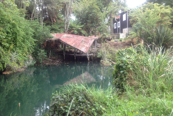
Storm damage? This old boat shed is probably wearied by age.
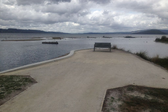
Alongside the entrance to this rest area is an unprepossessing entrance which after a reasonable long walk doglegs to the right to an open vista of Lake Rotorua. The compacted pathway – wide enough for four people walking abreast or similarly two cyclists – is level to the north, ending at the Waiteti Stream mouth.
Locals say it has been a good season for anglers, fishing off a promontory over recent weeks. The fish have been uniformly healthy, too, which tells something of the cleanliness of the lake. Another indication is that the fish have been biting strongly.
(In each lake, the fish take differently depending on the type of food they ingest. In my experience, Lake Rerewhakaaitu fished best, but that was many years ago.)
As we cycled along this track, a youth in an indolent moment cast from a red vehicle an projectile from shang-eye slingshot into the untroubled waters of Lake Rotorua. In the absence of fishing line, perhaps he was hunting finned food by bombardment.
Jane, a regular rambler, marvels at the improvements to the lakefront. It almost seems idyllic. The path is yet another link, if not a political promise, the gird the lake with a public walkway. Just recently, a former residential area at Hamurana has been converted into a walking track which stretches from the Hauraki Stream along Hamurana Domain opposite the golf course.
Some years ago, then Rotorua mayor Kevin Winters spoke of his desire to create a walking track around the lake. While difficulties for land ownership reasons and space may impede this wish (at Awahou and along Wilson's Bay/Mourea as examples), Kevin's hope was no pipe dream – an attempt is being made.
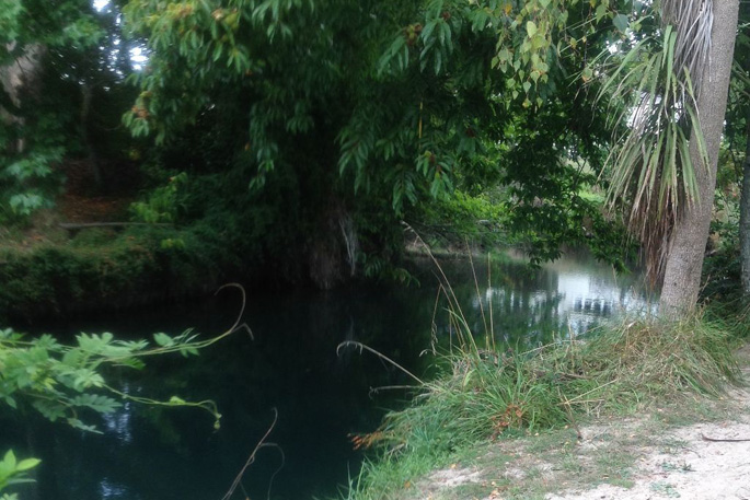
As it meanders to Lake Rotorua, the stream's colour changes to iridescent blue.
Jane told us last April's flooding took two moods. Where water rushed over banks at the Ngongotaha Stream, destroying property and damaging homes, the torrent along Waiteti Stream eroded banks. Not a home was flooded. Recently, the banks were reinforced by the NZ Transport Agency. Boulders shaped like huge hailstones were embedded along sections the bank.
Another group of walkers Rotorua Now came across pointed to the serenity of their walk alongside the stream. Depending on depth, the stillness in a subdued sunlight offered up various shades of blue, persuaded possibly by a dull light and the height of various trees which droop over the lake and added splendor to a walk alongside a stream uninhibited by man.
This walk starts at the stream's promontory, now much improved, past an arched footbridge. Heading north east towards the Waiteti Bridge, a lane passes manicured front lawns which, like those handsome buildings along the lakefront, are not always fenced off.
An element of trust then for ramblers. After a walk of 150 metres though within the bridge – the sound of motorists echoes distance – a sudden stop. Walkers hit the wall, on which is written: RESERVE ENDS HERE. Private Property.
We are reminded of an Oscar Wilde play, in which The Selfish Giant warns, 'Trespassers will be Prosecuted'.
Our return cycle is just as idyllic, the ports might say. The waters remain still, the stream's hues vary in blues – Prussian, bluebottle, iridescent, cerulean.
We will leave a trip along the Ngongotaha Stream for another day, soon. If the sudden rage last April 29 deeply affected a community – it did! – than moves to enhance safety and create an aesthetic experience for an overlooked part of the district will not be in vain.

0 comments
Leave a Comment
You must be logged in to make a comment.