The one feature about walks north of Rotorua is that they are peaceful, yet not far from continual bustle.
A track from Rotorua's Lake Road to Taui Street, Ngongotaha, (recently featured on this site) runs alongside a disused railway track. On the other side of a two-way bitumen track residential dwellings for the most part.
The second track from Taui Street to Waiteti Stream is new. It passes by a row of lakefront houses.
Our third amble, on a bicycle, takes us through some of nature's loveliest reserve, a walk alongside a twisting anaconda of a stream which at times rushes below what seems a ravine.
The casual stroller looks down on it. Though not inherently obvious during a walk, the banks on either side are steep, at times a chine.
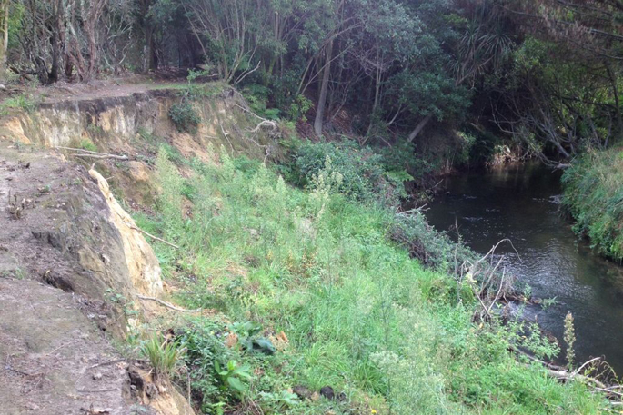
It also bears the scars of recent high waters.
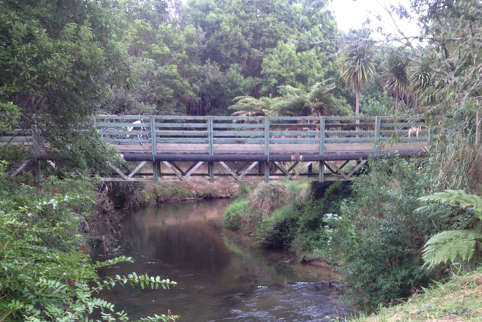
More likely, though, a reminder last April's flooding which caused havoc on neighbouring properties to the west of Elliott's Bridge, around 200 metres from the start of the walk.
The walk, orchestrated by village locals some 20 years ago and opened in 2001, is wonderfully constructed. Sadly, the floodings undermined some of the banks. On the southern side, the walk is widened by open fields. Across the river on the northern reaches, the stream runs alongside Western Road, the scene seven years ago of several sinking houses which played out on the national stage.
From the entrance at Ngongotaha Stream bridge, flora creates a lacey almost tendrilled thicket between the running waters and the start of Western Road.
There, we pass unnoticed lovely cottages, relics of another age. They have been well preserved and cared for.
The row is one of the village's most fetching features; alongside, a former fire station, though only a two storied operating building it could take a third floor, rests in vacant splendour– too grand to demolish, too awkward to inhabit it seems. Deserted now, it was last used as a restaurant.
A sign The Gantry provides the clue as to its last catering function.
An elderly rambler in lyra and her dog we countered described the track as 'pretty bumpy” – too bumpy for a ride on a bicycle. She spoke well.
Saturday was one of those fleeting autumnal days – to east of the bridge which shakes to heavy traffic, locals and well-dressed anglers fish for breakfast. Fishing has been sound this season.
Because of its character and contours, this track is the best of the village's tree rustic walks. Tangles of thin branches trees had listless over the babbling stream.
No weirs to break the run are evident. Houhere (lace bark) and kowhai, manuka and kanuka consolidate much of either bank.
The notice says the banks were 'stark naked” before locals turned into a nature walk.
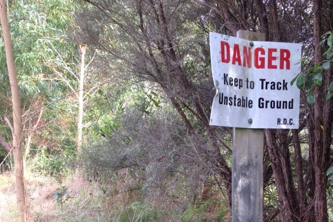
The hoarding at Elliott Bridge is informative.
At its angriest, the stream rises by three to five metres. Mosses and lichens were established to stabilise banks.
Harakeke (flax), purei (grass)
Further upstream beyond Elliott Bridge the walker strains. Nature has enclosed the track, neglected over recent times. The venturer does not know whether he or she is lost, stolen or strayed.
A sign warns of danger. It is here the banks have eroded. The have not been re-contoured or reinforced in some time.
It is no longer a walk but an obstacle course.
Presently, we are confronted by a grove of maturing bamboo shoots. Exports to China?
Our walk ends here. The bicycle alongside which we walk is tossed over a fence, into a paddock owned by the famous Agrodome. Then wheeled out to nearby Western Road, not far from the main Agrodome entrance. Bleeding on both forearms from defences of the under and overgrowth.
The end of the line maybe.
Overall, though, the track creation is a wonder tribute to the good folk of Ngongotaha and environs.
Twenty years ago, they plied intensive sweat equity to enhance the town.
Mission accomplished.

0 comments
Leave a Comment
You must be logged in to make a comment.