A westerly flow dominates NZ today but as we head into the weekend, a large low moves through with varying wind directions and areas of rain, showers and some snow on the ranges.
Westerlies continue today and strengthen to northerlies in some northern areas on Friday ahead of the low, while southern areas see lighter winds, says WeatherWatch.co.nz
By Saturday the low is smack bang over the South Island bringing a westerly flow to much of the North Island while the South Island has light winds or cooler south easterlies.
"This set up encourages rain on the South Island's east coast while the North Island's western half is more likely to have showers. Snow falls on the Southern Alps at higher levels with heavy falls on the summits.
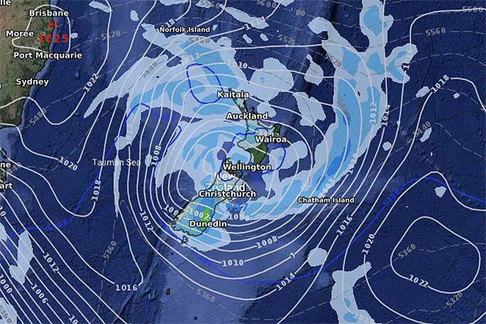
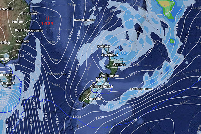
"On Sunday the centre of the low slides northwards and should lie north of Bay of Plenty and East Cape by noon, this set up favours easterlies in many eastern areas and and lighter varying winds in the north.
"Showers hug the eastern South Island and around the north east of the North Island."
Next week actually may kick off with an easterly quarter flow but those dominating westerlies do look likely to return later next week - but may not be so powerful across next week itself (compared to this week) based on latest modelling today.
Finally, WeatherWatch.co.nz says rainfall totals don't look too extreme with a number of places getting 10 to 30mm in the next few days.
 12pm on Sunday.

0 comments
Leave a Comment
You must be logged in to make a comment.