Scientists working in future disasters will have faster, easier access to past datasets, as Toitū Te Whenua Land Information New Zealand moves towards cloud storage.
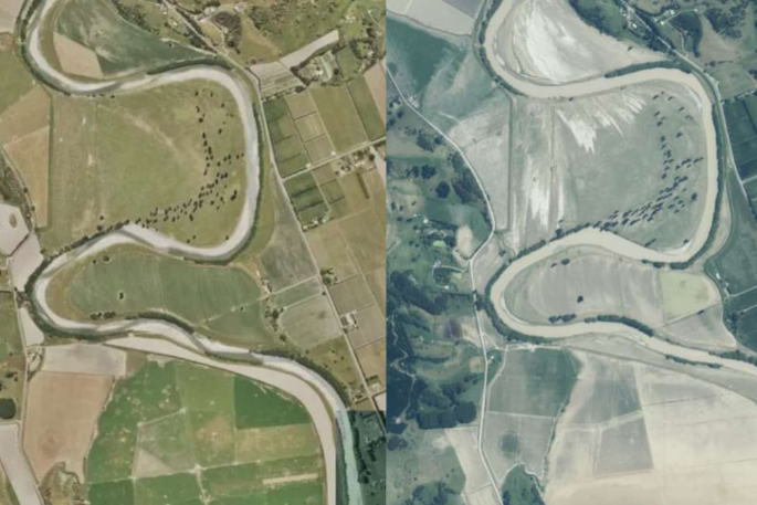
As part of the open data programme run by Amazon Web Services, 20 terabytes of aerial imagery going back to the 1970s is initially being made available to the public on the cloud.
LINZ is the second organisation to join the programme, following GNS Science.
Amazon Web Services country manager Tim Dacombe-Bird says storing data in the cloud made it readily available globally, and accessible quickly.
"Previously, to share these large datasets... [LINZ] would have to ship hard drives around the country or they'd have to break the datasets up into smaller components," he says.
"It adds a layer of complexity, but it also adds the burden of time for the analysis."
Users, including scientists, researchers, and governments, but also members of the public, would now be able to access all of these images through the Registry of Open Data.
Aerial imagery can be used when disasters hit. During Cyclone Gabrielle, an aerial view allowed agencies to assess the damage and allocate resources more efficiently.
LINZ made satellite and aerial imagery covering a third of the North Island available when the on the cloud for the agencies involved in the response.
LINZ head of location information Aaron Jordan says it was usually those outside the disaster zone who were dealing with the data.
"What typically happens in an event is those who aren't affected are often the ones that are collecting and coordinating the imagery... and then provisioning it to people who can make assessments," Jordan says.
"Those assessments can then be passed down through other channels, like radio, to people on the ground."
In those cases, the faster they could get the information, the better.
Jordan says Toitū Te Whenua would be adding more images as they became available, eventually extend back to the 1940s.
It was paid for by the AWS Open Data Sponsorship Program, which covers the cost of storage for publicly available high-value, cloud-optimised datasets.

0 comments
Leave a Comment
You must be logged in to make a comment.