
With sweltering temperatures set to continue for most New Zealanders on Saturday, it’s high time to take advantage of the heat, sun and beach visits.
MetService issued a heat alert on Saturday for Auckland, where the temperature is forecast to get to 28C, and it’s expected to be “uncomfortably warm and muggy”.
Other places with MetService heat alerts on Saturday include Blenheim, Christchurch and Dunedin – all forecast to reach 31C, with developing northwesterlies. There’s also a heat alert for Timaru, where the top temperature is expected to be 29C.
In Tauranga, the temperature is expected to rise to 27C around 3pm, with a low northerly breeze helping with the humidity.
You may need to pack an umbrella for the commute to work by Monday, with rain watches already issued in some parts of New Zealand.
MetService meteorologist Dan Corrigan told Stuff a band of rain starts moving up the West Coast on Saturday afternoon in Fiordland, and will continue up the South Island on Sunday.
It will continue across the North Island on Monday, with a few places set to experience heavy rain.
On Saturday, a heavy rain watch is in place for Fiordland from 5pm until 11am on Sunday with periods of heavy rain expected.
 Jack Wadner cools down at Auckland's St Leondard's beach on Friday. Photo: David White/Stuff.
Westland also has a heavy rain watch in place on Sunday, from 5am through until 11pm, which could approach warning levels around the ranges. Headwaters of the Otago Lakes and Rivers from 3am until 1pm on Sunday.
Dan says there is a low confidence rain could approach warning criteria in Taranaki and Eastern Bay of Plenty on Monday.
Strong wind watches have also been issued in Fiordland, Southland, Stewart Island and Clutha between 10am and 10pm on Saturday, where northwest winds could approach severe gales in exposed areas.
As for the heat that’s made itself at home around the country throughout the week, those high temperatures are set to continue for the weekend, but will cool down coming out of the weekend.
Gisborne, Wairoa and Hastings, as well as a few Eastern places in the South Island could exceed 30C, but “as we go into Monday, we do see a southerly change heading its way northwards up the eastern parts of the country”.
“That’ll cool things down in Canterbury and Otago on Sunday,” says Dan.
On Monday, that southerly will “really cool things down”, particularly in areas like Hawke’s Bay and Gisborne.
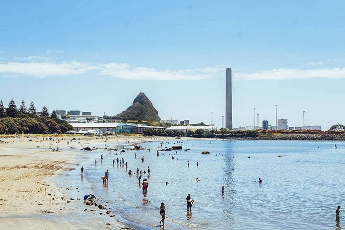 The hot temperatures are set to continue through the weekend, but will cool down by Monday. Photo: Vanessa Laurie/Stuff.
And the sudden shift from very high temperatures will make the drop “really noticeable”, with Hastings expecting a Tuesday high of just 20C, down from a weekend high of 30C.
Despite a wet start to the week for many, the rain shouldn’t stick around too long.
After Saturday night and Sunday in the South Island, Monday in the north, and Tuesday in the upper North Island, things should dry out fairly quickly for the rest of the week.
“Tuesday looks like most of the rain clears out, apart from the upper North Island,”says Dan.
From there, “it’s looking like a fairly dry week ahead”, although “it’ll take a couple of days for the temperatures to rebound after that southerly”.
There will be “noticeably cold temperatures” that will “clear out that warm air that’s been hanging around”.
Good news for anyone who’s been struggling to sleep through the muggy, hot nights, however. Those evening temperatures are also set to drop next week, with Alexandra, Wānaka and Queenstown looking at a low of 5C on Monday and Tuesday.

0 comments
Leave a Comment
You must be logged in to make a comment.