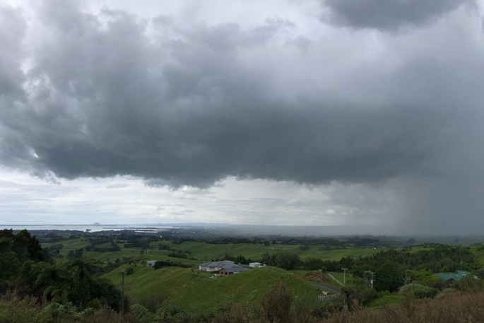
Thunderstorms are moving up the country and are due to hit much of the North Island as temperatures start to drop.
"We currently have an active front that is impacting the country," MetService meteorologist Dom Barry told Morning Report on Tuesday.
"It has affected the likes of Westland already this morning - there have been quite a number of active thunderstorms there already."
A heavy rain watch was in place for the Westland and Grey districts and Southland from the Oreti River westwards until 8am.
Dom says the front is moving toward the likes of Kāpiti, Taranaki and the northern parts of Waikato and Taumaranaui.
"We're expecting that to affect the rest of the North Island throughout this afternoon and into this evening.
"We're also expecting the possibility of some thunderstorms for the Canterbury region this morning as well."
The thunderstorms aren't expected to reach the severe category, but Dom encourages people to keep up to date on the MetService website and app in case that changed.
There will be a rain for "a lot of places" - though the downpours will miss Hawke's Bay and Gisborne, says Dom.
Cooler weather is starting to arrive after Monday's scorching heat that saw Wellington airport breaking its January record with 29.6C, and Kawarau hitting 32C.
"Temperatures are starting to drop [for] the majority of the country," says Dom.
Wanaka and Queenstown will get to 18C or 19C, with an overnight low of 4C.
The heat has set up a "perfect mixture" of conditions for thunderstorms in parts of the lower North Island on Monday, with warm moist air from the north and the atmosphere a little unstable, meaning the air could rise.
"That air could rise up really high and generate some really, really intense downpours in some areas."

0 comments
Leave a Comment
You must be logged in to make a comment.