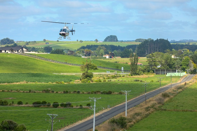
Ever wondered why PowerCo uses helicopters rather than drones to take aerial views of power poles? PoweCo's recent update about their maintenance work this summer is catching the interest of some of their customers on social media.
Late last year, PowerCo photographed 36,600 poles across their electricity network from a helicopter – bringing the total of poles photographed during the past five years to almost 200,000.
"This work allows us to find and fix any faults to help keep your lights on," says a PowerCo spokesperson.
"Thanks to this photography, just this summer - from November 2023 to Janurary 2024, 292 defects which could have caused loss of supply or critical systems have been identified and remedied."
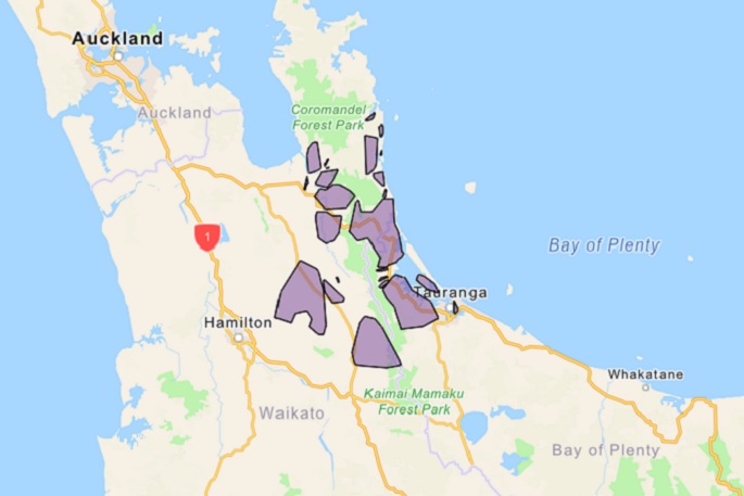
Areas where the helicopter operated
The work was carried out in stages, starting in the Bay of Plenty, Coromandel, Manawatū and finishing in Taranaki.
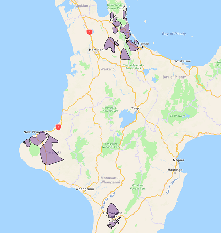
The flight areas are indicated by the purple blocks on the map – these are a general guide only. Image: PowerCo.
The photography work is managed by Aethon Aerial Solutions, who contract local pilots to carry out the work.
"Your privacy will not be impacted by our survey work. We are only taking photos of our poles and crossarms, not residential properties," says a PowerCo spokesperson.
"The photos are for internal asset assessment purposes only and are held in a secure location.
"Thank you to those customers who contacted us to check if your specific address was impacted."
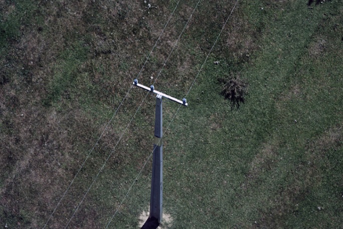 Example of a power pole photograph. Photo: PowerCo.
As per Civil Aviation Authority requirements, the helicopter only flies in open air space. That means it flies above 1,000 feet in urban areas, and above 500 feet in rural areas.
Why helicopters instead of drones?
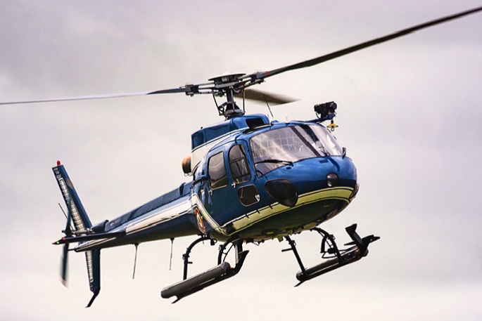
Helicopters instead of drones for this work for a number of reasons.
"Drones available on the commercial market are not big enough to support the equipment required to carry out the type of work we are doing," says a PowerCo spokesperson.
 Late last year, PowerCo photographed 36,600 poles across our electricity network from a helicopter. Photo: PowerCo.
"Drones lack the ability to provide us with the quality and range of photographs we require to assess our assets.
"Drones can only last for a short period in the air before they need to be charged.
"It would require someone to travel with it on the ground across the network, which would be inefficient. A helicopter can run for several hours and cover much greater distances."
Powerco say they often get asked why they don't put all power cables underground.
"We have more than 28,000km of electricity lines and cables connecting homes and businesses in our area, covering the eastern and western North Island – including rural areas.
 The flight areas are indicated by the purple blocks on the map – these are a general guide only. Image: PowerCo.
The cost of placing all existing overhead electricity supply underground would be prohibitive. However, power supplies in new subdivisions in Powerco’s network area are placed underground if possible."
PowerCo say they know the noise from the low flying helicopters used for the photography can unsettle some animals.
"We do all we can to work with you to help reduce impacts to animals. Thank you for your patience and understanding while we carried out this project."
Click here for more: www.powerco.co.nz/helicopter
">

0 comments
Leave a Comment
You must be logged in to make a comment.