A forecast of snow at the beginning of the week has now changed to northwesterly winds.
This means temperatures jumped up into the high twenties for some places, in typical Spring weather fashion.
"A front, which is bringing heavy rain to the west of the South Island and severe gales to inland Otago and Canterbury, is expected to move northwards up the country, with temperatures dropping several degrees after it makes its passage," says the MetService.
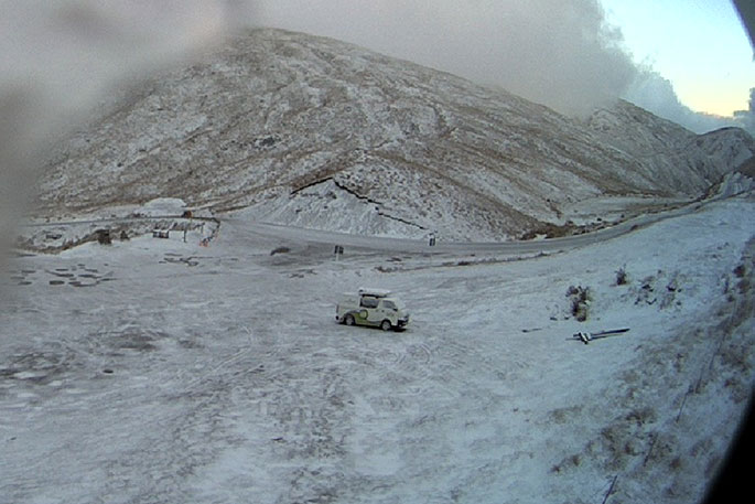
"Snow fell down to 300 – 500 metres altitude on Tuesday and Wednesday this week, including a thin layer accumulating on the Crown Range Road, as shown in the webcam image below.
"The coolest temperatures recorded this week were on Wednesday morning, with Tekapo being the coldest spot in the South Island, dropping to -1.1C, and Waiouru taking the title in the North Island with 0.1C. Many others felt the chill as well, with cold southwesterly winds covering the country."
As the southwesterly winds eased, they began to turn northwesterly ahead of the next front, approaching from the Tasman Sea.
Northwesterly winds across the Southern Alps have meant that temperatures have taken a jump during Labour Weekend.
'As the strong northwesterlies come over the Alps, the air dries out on the windward side as it is pushed up against the mountains,” says MetService Meteorologist Claire Nickson.
'As the air, now drier, descends down the leeward side of the Alps, it can warm up quickly, meaning we can see some very warm temperatures in this situation.”
On Saturday, the warmest temperature recorded was 28.4C at Millers Flat near Roxburgh.
On Sunday, the east coast of the North Island is expected to see warm temperatures and northwesterly winds as well, before a front moves up the country today and Monday, dropping the temperatures back several degrees.
There are presently several Severe Weather Watches and Warnings out associated with this front – for heavy rain for Fiordland and West Coast, and severe northwest gales for inland Otago and Canterbury during Sunday. Head to our website for full details and the latest updates.

0 comments
Leave a Comment
You must be logged in to make a comment.